
By Saumik Paul, Anikha S. Kumar, Jibin J K and Bhagya Gopakumar
For generations, the vast paddy fields of Kuttanad, in the Indian state of Kerala, have sustained farming communities and contributed significantly to the state’s rice production. Known as the “Rice Bowl of Kerala,” Kuttanad is unique because it is the only place in India and one of the few places in the world where rice is cultivated below mean sea level (1.2 – 3 meters), thus making the region both agriculturally unique and environmentally vulnerable. Its below-sea-level farming system has been recognised by the UN Food and Agriculture Organisation as a Globally Important Agricultural Heritage System since 2013.
Part of the wider wetland, the Vembanad-Kol system, is also a Ramsar site of international significance. It holds about 43.5 thousand hectares of cultivable land and over 215 thousand tonnes of total paddy output in regular harvesting seasons. The Kuttanad also holds the sobriquet ‘Netherlands of the East,’ since the region has a lot in common with the Dutch polder system.
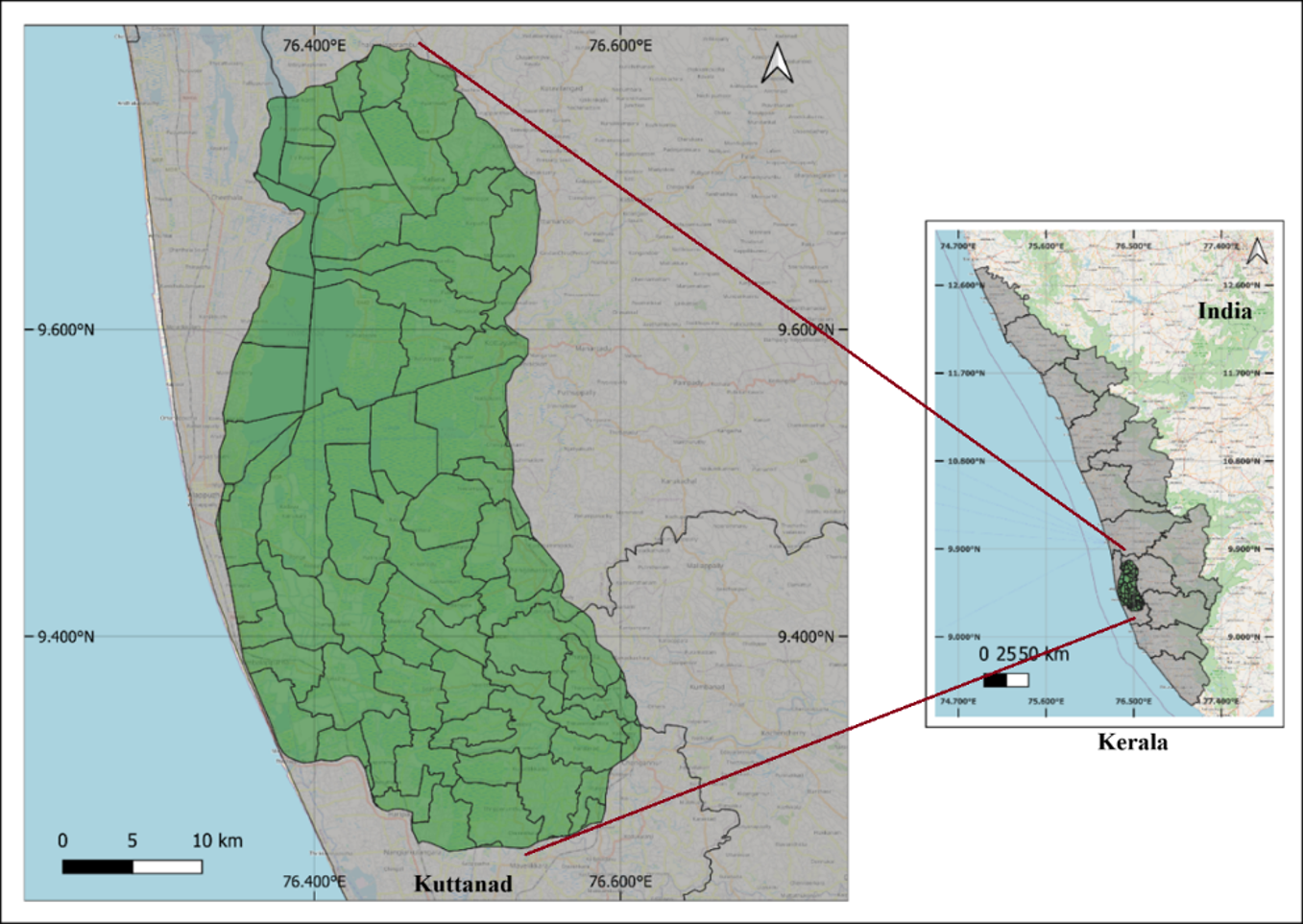
Figure 1: Kuttanad region. Source: Author’s contribution
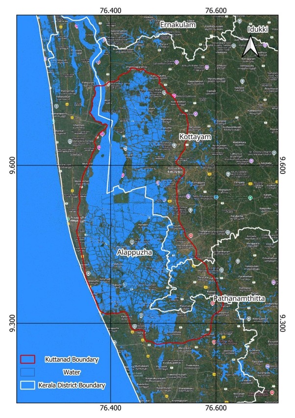
Figure 2: Kuttanad during 2018 flood in Kerala. Source: Author’s contribution.
Yet today, this remarkable agricultural landscape faces escalating challenges. Flooding and saltwater intrusion have become a recurring challenge, threatening rice production, livelihoods, and food security. Paddy cultivation, capture fishing, and other dependent livelihoods in the Kuttanad region revolve around a delicate balance between fresh and brackish water. However, the past few decades have seen this balance frequently disrupted by changing land use, water regimes, and other developmental agendas.
The problem is closely linked to Kuttanad’s geography and escalated by human interventions with partial and inadequately planned development efforts. Farmers depend on rivers and canals for irrigation, and these are highly vulnerable to the intrusion of saline water from the Arabian Sea. The salinity tolerance threshold of paddy varieties cultivated in Kuttanad is approximately 2 ppt (parts per thousand); however, salinity levels frequently exceed this limit. Resulting annual crop losses due to lower yields, poor-quality harvests, and damaged rice panicles amount to roughly £25 million.
Two structures were built to help the situation: the Thanneermukkom bund and the Thottapally Spillway, which were established to control saltwater intrusion and to drain excess floodwater, respectively. However, farmers across Kuttanad describe these same structures as a central part of the problem they now face.
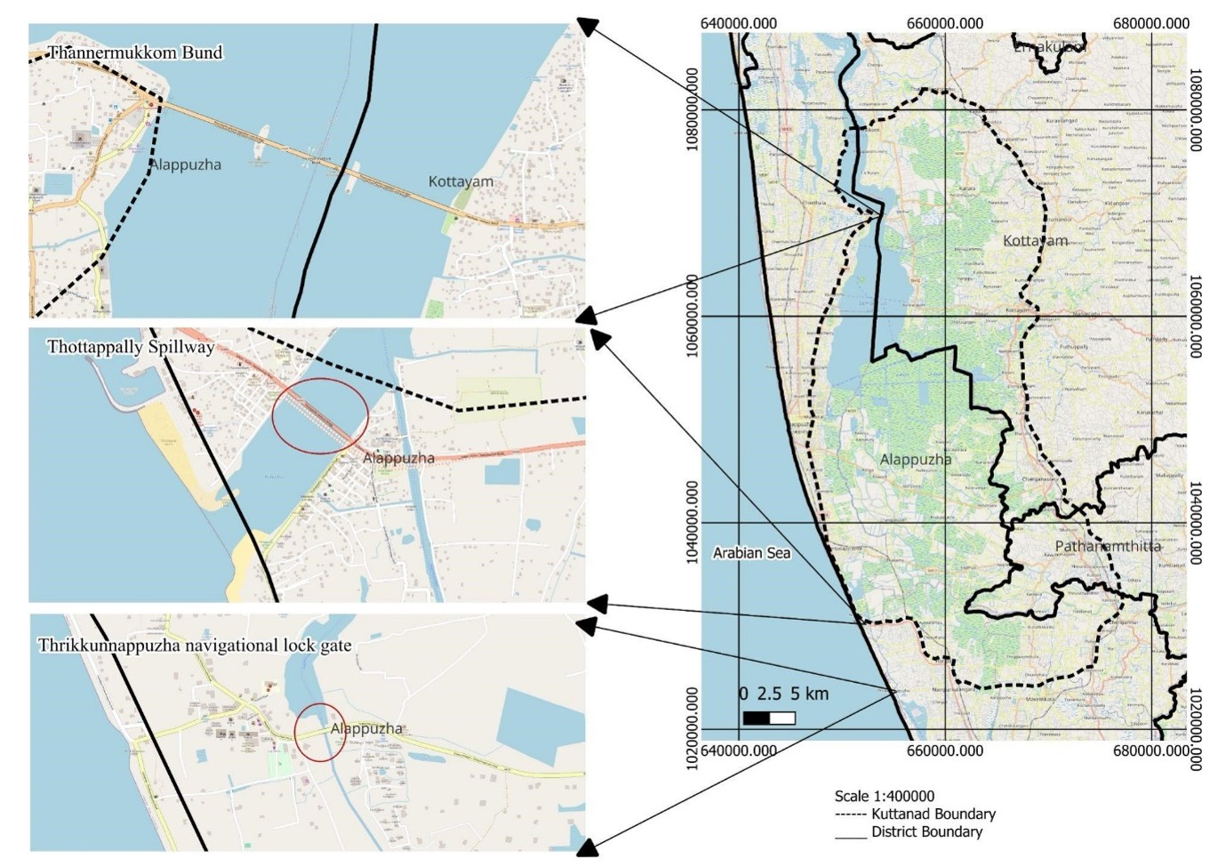
Fig 3: Major man-made structures for water regulation in Kuttanad
What can be done to protect this unique agricultural ecosystem of Kuttanad? In 2010, a comprehensive development initiative was designed to improve water management, strengthen agricultural infrastructure, and enhance farmers’ livelihoods in Kuttanad. A recurring concern is the limited implementation of this much-publicised Kuttanad Development Package as government efforts to protect the region’s fragile farming ecosystem have fallen short.
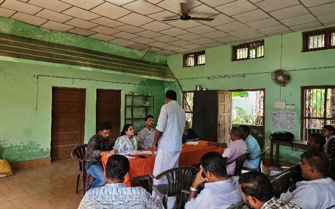
Rather than generating new technical knowledge, our fieldwork in Kuttanad began with a simple question: what can we learn from the people who live with these challenges every day? We ran focus group discussions with rice farmers across six panchayats (Champakulam, Kainakary, Nedumudy, Pulinkunnu, Thakazhy, Purakkad) spanning four agroecological zones, chosen to be representative of Kuttanad’s major rice-producing areas. The aim was to surface farmers’ own views on barriers preventing their water-management knowledge from being effective.
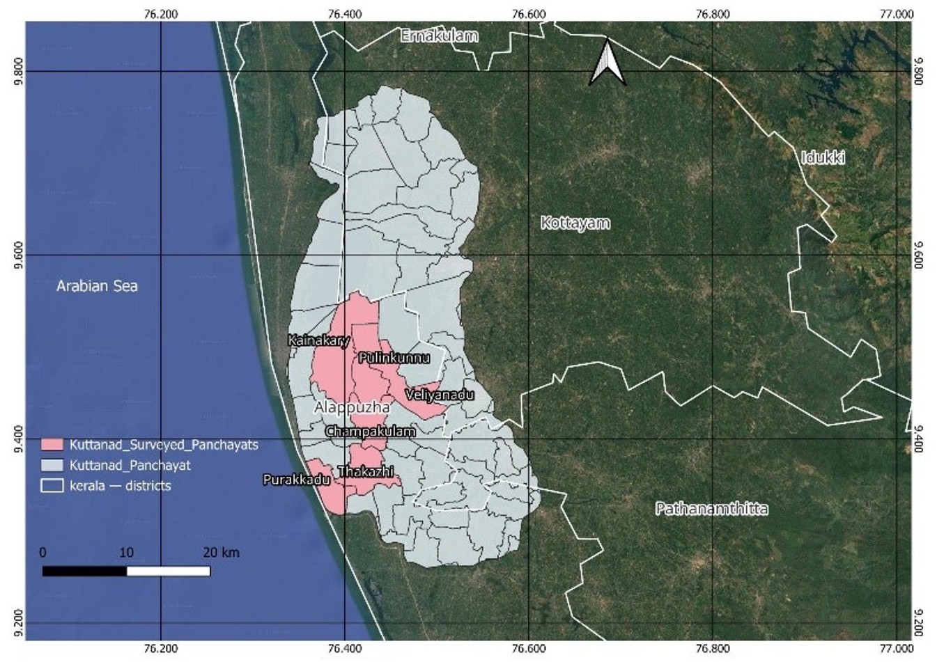
Fig 4: A map of the sampled panchayats
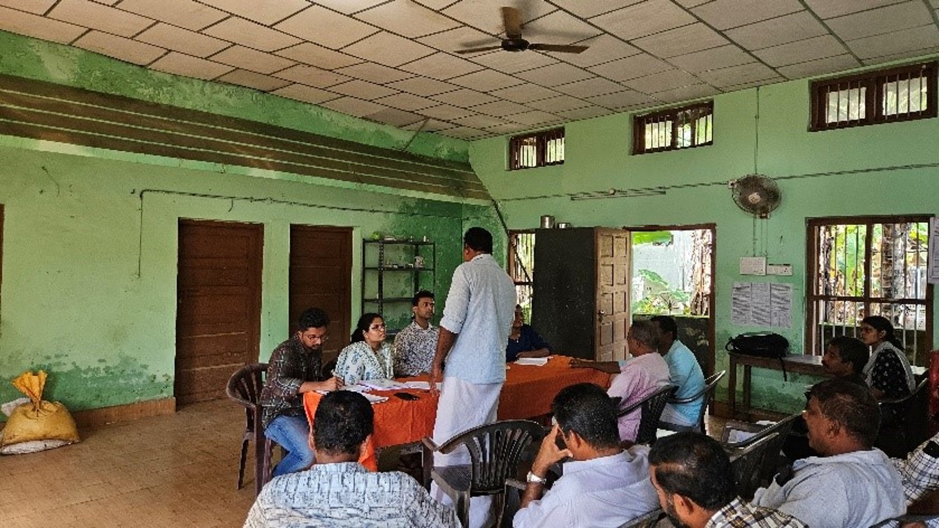
Fig 5: Focus group discussion with farmers
Despite covering different panchayats, the discussions highlighted similar concerns, identifying flooding and saltwater intrusion as the greatest threats to rice cultivation. Many farmers linked these problems to the operation of the Thanneermukkam Bund and the Thottappally Spillway, believing that shutter operations often failed to match the local rainfall, tidal conditions, or the agricultural calendar. Weak bunds, inadequate drainage, sediment accumulation in canals, poorly designed roads and bridges, and insufficient pumping systems were repeatedly identified as some of the main factors in worsening flooding and saline intrusion. It was also noted that the infrastructure designed to protect agriculture could obstruct natural water flow instead.
A recent report from the field confirms that Thottapally Spillway has now becomes a saline water entry point. To a large extent, the government’s development agenda proved ineffective due to its disregard for the vulnerabilities of the region. However, beyond these challenges, the participants pointed towards the poor coordination among government departments, delays in project implementation, inadequate maintenance of infrastructure, and limited consultation with farming communities. Many farmers feel their local knowledge is rarely incorporated into planning, despite generations of experience in the region.
The measures proposed by farmers include automated shutter operations at the Thanneermukkam Bund and Thottapally Spillway using sensor-based technology; strengthening bunds using durable materials such as laterite blocks and concrete; regular dredging of canals and Vembanad Lake, with the resulting alluvium reused for bund construction; the establishment of early warning systems for flooding and salinity intrusion; regular soil and water quality monitoring; and the appointment of nodal officers to improve coordination across departments. Considering the sensitivity of the Kuttanad region, it is also imperative that farmers be included in local planning and decision-making processes and their local knowledge be utilised. It is hoped that reflecting on these discussions could improve the chances of overcoming these barriers and create wider impacts across communities involved in agriculture and water management in the Kuttanad wetland ecosystem.
The vulnerability of Kuttanad is not simply a story of environmental decline. It also highlights the practical knowledge and about the resilience of local farming communities. Rather than treating farmers as passive victims of climate and environmental change, they should be placed at the centre of identifying solutions. The central message is clear: protecting Kuttanad’s agricultural future depends on combining scientific innovation with the experience and knowledge of farming communities. As climate change intensifies pressure on the low-lying agricultural regions worldwide, Kuttanad offers an important lesson: sustainable adaptation is most likely to succeed when farmers themselves are part of the solution.
Note: This article gives the views of the author/academic featured and does not necessarily represent the views of the Global Development Institute as a whole.
The authors would like to thank the Global Development Institute’s Transformation Lab for financial support for this project.
Please feel free to use this post under the following Creative Commons license: Attribution-NonCommercial-NoDerivatives 4.0 International (CC BY-NC-ND 4.0). Full information is available here.